Sightseeing in Israel
Off the Beaten Path with Ethan Bensinger
« Exploring the Northern Negev: battle sites, Bedouin, and ancient desert cities | Home | In the shadows of the Gilboa Mountains: a basilica, ancient synagogue, Crusader castle and kangaroos too! »
A tour of the lower Galillee with a visit to an Ottoman-era train station, a Templer agricultural settlement and an ancient Jewish cemetery
By Ethan Bensinger | May 6, 2010
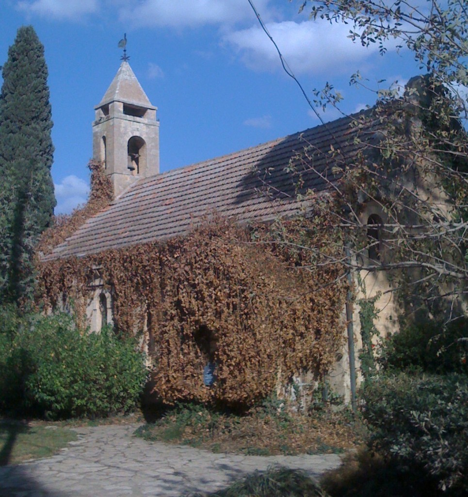
Today’s “off the beaten path” travels will take us to the north-western section of Israel’s breadbasket, the Jezreel Valley, to observe the impact that Muslims, Christians and Jews had on the development of Palestine at the beginning of the 20th century. We will explore the renovated Ottoman-era train station at Kfar Yehoshua, through which Muslim pilgrims from Haifa and surrounding villages passed on their way to The Haj in Mecca, as well as the agricultural Templer and Evangelical Protestant communities of Bet Lehem Ha Glilit and Alonei Abba. At the end of our day we will jump back 2,000 years in time to visit the remains of an ancient Jewish city and cemetery with its ornate tombs at the nearby Bet She’ Arim National Park.
Travel time between Tel-Aviv and our first destination will be between 60 and 90 minutes. Follow the coastal road, Route 2, to the Zichron Yaakov exit. Then follow Route 70 past Bat Shlomo and Elyakim through the town of Yokneam. Alternatively, you can take Route 6 from Jerusalem or Tel-Aviv and exit at Yokneam. Turn right at the Hatishbi junction onto Route 722, and then shortly thereafter, take another right at the brown directional sign toward the Hejaz railroad station and Moshav Kfar Yehoshua. Follow this road for several kilometers and at the circle take the first right toward the old stone buildings.
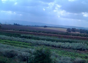 You have now entered the Jezreel Valley, called in Hebrew Emek Yisrael, which today is home to countless moshavim and kibbutzim harvesting much of Israel’s grain, cotton, produce and sunflowers. In antiquity the valley saw epic battles between the Egyptians under the leadership of Pharaoh Thutmose III, and the King of Kadesh, Gideon and the Midianites, Saul and the Philistines, and Romans against Jewish forces. In modern times, Napoleon led his French troops through the valley as did General Allenby in his advance against Ottoman forces in World War I.
A decade before the outbreak of the the war, the Ottoman Sultan commissioned the laying of a railroad line through the Jezreel Valley for strategic military reasons and as a way to facilitate the pilgrimage of his subjects in Palestine to the holy cities of Mecca and Medina. Of course, the Sultan hoped that his magnanimity would also bolster his image as the head of Islam throughout the Muslim world.
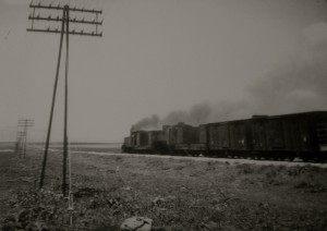 The Sultan engaged the services of the German engineer Heinrich Meissner, whose team of European trained professionals, supported by 10,000 Ottoman soldiers, completed the railroad’s Jezreel Valley leg in 1905 by linking Haifa with the Hejaz Damascus line in the Jordan Valley. (Remnants of this line can be viewed at Naharayim, off of Route 90 in the Jordan Valley.) Three years later the remainder of the route to Mecca was completed by Meissner’s team, permitting Palestinian Muslims to more easily travel to the Arabian peninsula.
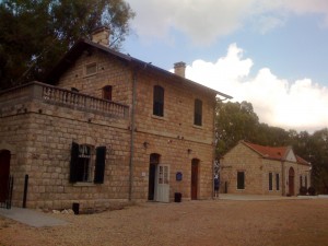 Steam locomotion was the only means by which the train could be powered and that required sources of water and timber along the route. Luckily, well water was found near the entrance to the Jezreel Valley, which for Meissner, proved to be an excellent location to develop the Tal Ish-shammam train station. Following identical blueprints from stations built throughout the Ottoman Empire, Meissner built seven stone buildings and a water tower, which we will visit today.
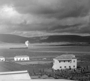 The first decades of the 20th century also saw a marked increase in the development of Jewish agricultural settlements in Palestine, with kibbutzim and moshavim being built near water and railroad lines whenever possible. The founders of Kfar Yehoshua understood the value of locating their new settlements near the Tal Ish-shammam train station as it would open markets for their produce in Haifa and other seacoast communities. The train also served as a communication life line between the Jewish settlements in the Jezreel Valley as farmers standing along the route could exchange information with passengers on the slow moving steam train.
With the collapse of the Ottoman Empire the name of the train station was ultimately changed to that of the nearby moshav, Kfar Yehoshua, and the route through the Jezreel Valley became affectionately known as the “railroad of the valley”. During the British Mandate, the train became part of the British railway system and three daily trains travelled between the settlements. The line and station were abandoned during Israel’s War of Independence, and it was not until several years ago that the Society for the Preservation of Historical Sites in Israel decided to rehabilitate the site.
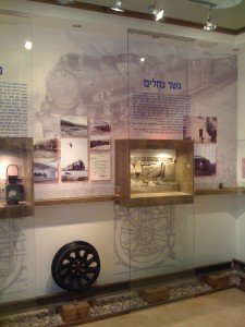 Pull into the parking area adjacent to the iron fence surrounding a complex of beautifully restored stone buildings, train carriages and a water tower. Make your first stop the deputy station master’s house which today serves as a childrens’ arts and craft workshop. At the adjacent visitors center, which was formerly the station masters home, you can examine artifacts, maps, train schedules and other memorabilia hearkening back to the days when the station was in use. You can also view an assemblage of black and white photos depicting passengers at other railroad stations in Palestine. Most impressive though are the early photographs of the train making its way through the Jezreel Valley, and later standing to take on water and passengers at Kfar Yehoshua. A short film, which can also be viewed with an English narration, incorporates vintage movies and pictures of the train, Ottoman officials, and neighboring moshavim and kibbutzim. The movie should be of interest to children as well, as it effectively uses graphics and humorous pop-ups to tell the story of the valley of the train. Across from the visitors center are two restored train carriages which sometimes also serve as an art gallery. Interestingly, the railway car’s old wooden sleepers are now being reused as benches in the movie screening room. And, not far from the old station, new tracks are being laid to once again connect Haifa and Beit Shean!
The valley of the train visitors center is open daily from 9-2. The contact number for the site is 04-9534226 or 052-722-0139.
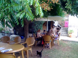
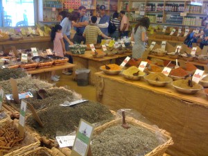 Return to Route 722 and turn right for approximately 3 kilometers. Turn right again at Route 75 and then immediately left on Route 7513. Follow this hilly and forested road for several miles in the direction of Allonei Abba, but pass this moshav for now and proceed a short distance to a dirt road leading to the Herb and Spice Farm. The farm merits a short visit, especially on Saturdays as you can enjoy a good cup of coffee and some home baked cake or cookies on the patio overlooking the fields of the Jezreel Valley. However, the rich aroma of hundreds of spices will no doubt entice you to spend some time in the store, where the helpful staff can be of invaluable assistance. Be sure to wander through the herb plantings in front and behind the store and to pick up the English language handout describing the medicinal effects and recipes for twenty popular spices including anise, cumin, turmeric and mustard seed. The farm is open daily from 8:30 to 6, but closes one hour earlier on Friday.
Now retrace your steps back to the entrance of Alonei Abba/Waldheim and follow the main road, past the modern community, to the vine covered stone church. It is no coincidence that the two main streets of the village, with the church at their center, take the form of a cross, as the village was founded by Christian Germans affiliated with the Prussian Evangelical Church. These Protestant settlers were initially part of the Haifa branch of the Templer Society in Palestine, but because of a schism in the movement, were offered financial assistance to form a separate settlement in the countryside called Waldheim (forest home).The purchased land was part of the Arab village of Umm al-Amed and was owned by absentee landowners residing in Beirut.
In the 1930s the Waldheimers, along with many of the other Templers in Palestine, joined the Nazi Party, and with the onset of World War II, the British Mandatory government in Palestine declared them to be enemy aliens. Consequently, the residents of Waldheim, and the Templer movement’s residents living in nearby Bet Lehem Ha Glilit, were interred in their communities. Some of the Templers in Palestine were later deported by the British to Australia, while others returned to Germany in the early years of the war. Another group of Templers were repatriated to Germany in exchange for 200 Jewish female inmates from the Bergen Belsen concentration camp. A small group of residents remained in Waldheim until the founding of the State of Israel in 1948.
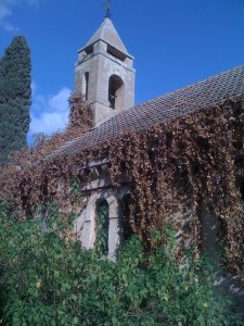 Start your walking tour of the village at the church which was designed as a basilica by the Haifa -based, German architect, Otto Lutz. It is of simple stone design which is typical of Protestant churches. Yet, its beautifully tiled floor, arched and port hole style windows and broad steeple, add a symmetric and elegant dimension to the structure. Construction commenced in 1916, but because of the war, its inauguration was delayed until 1921. Thereafter, a minister would travel from Haifa to conduct Sunday services at the church for the Waldheimers and some residents of neighboring Bet Lehem Ha Glilit.
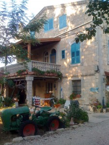 Proceed down on either side of the streets and note some of the original two story stone homes bearing a mix of German and Arab architectural elements, including balconies and porches with wrought iron gates, copper gutters leading to cisterns in the cellar, window flower boxes and wooden shutters, some of which are adorned with carved flowers and hearts.
Across the street from the church is a home built in an unusual octagonal style. Adjacent to the church is the home and art gallery of Hannah Levav. Hannah is a second generation resident of Alonei Abba and will be happy to escort you or a group through the village for a fee. Hannah can be contacted at 04-983-5412.
Walking with Hannah through the small village is to take a step back in time to when her parents and other members of a group of Zionist volunteers from Romania, Austria and Czechoslovakia, settled in abandoned Waldheim in 1948. Most of these young people were members of the Hanoar Hatzioni Zionist youth movement in their home country, and having survived the horrors of Nazi Europe, now attempted to enter Palestine on the refugee ship, Darion II. The rickety old boat was intercepted by the British for attempting to run their blockade of Palestine, and its load of refugees were interred behind barbed wire fences at the Atlit and Mizra prison camps. With the founding of the Sate, arrangements were made for their resettlement at Waldheim.
Hannah will also be happy to tell you about the heroic efforts of Abba Berdichev, the namesake of the village, who as a member of Hanoar Hatzioni, volunteered to parachute into Nazi Europe to organize Jews for their ultimate immigration to Palestine. His valiant efforts cost him his life, together with other parachutists such as Hannah Senesh. Be sure to also ask Hannah about the numerous sites in Alonei Abba that served as the setting for local resident Meir Shalev’s novels, “Fontanelle” and Pigeon and a Boy”.
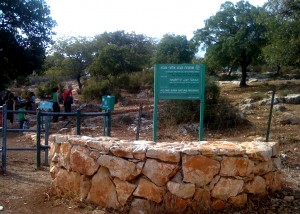 As you walk down the pine tree-lined streets, you may note the nature reserve in the distance. The name Alonei in Hebrew means oak, and indeed the 240 acre nature reserve is today a sanctuary for a small number of Tabor oak trees remaining in Israel. Before the outbreak of World War I, Tabor oaks were a common site in the lower Galillee and near Hadera along the sea shore. The Ottomans deforested much of Palestine during the war, but thanks to the strenuous efforts of the residents of Waldheim, the Tabor oaks surrounding the village were saved.
Abbie Rosner, another resident of Alonei Abba, and a transplant from the United States, offers culinary tours of the region. You can check out Abbie’s site at www.galileecuisine.co.il, and if time permits, be sure to book one of her tours to discover herbs, cheeses and other delicacies from the Galillee.
Return to the entrance of Alonei Abba and proceed right, past the Herb and Spice Farm, to Beit Lehem Ha Glilit (Bethlehem of the Galillee). Though the village is best known for its Templer homes and farms, the site dates back to the Roman and Byzantine eras ( 2nd and 7th centuries A.D.). In fact, some biblical scholars ascribe the area as the true Bethlehem in the Jesus narrative because of its proximity to Nazareth.
Strolling under the arched canopy of trees lining the main street, and by the gardens of some homes, you’ll pass numerous archaeological remains such as oil and wine presses, cisterns, columns and bases, and artifacts salvaged from nearby tombs. An impressive mosaic floor, with representations of birds, animals, grapes and geometric designs discovered at a Byzantine era site in the village, is now prominently displayed at Ben Gurion airport as your proceed down the ramp toward passport control. Though ancient Beth Lehem Ha Glilit was destroyed in the 7th century A.D., archaeologicalal evidence supports continued habitation through the time that the Templers purchased the land from an Arab family in the 1890s.
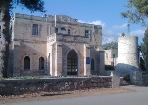 As you approach the Templer community center and adjacent water tower, note that the architectural elements of the center’s elegant stout design, arched wooden doorways and windows, use of pitched stone slabs and sharp angles, are reminiscent of the Protestant church in nearby Alonei Abba. Though the center is now closed to the public, you can peek into the windows and walk around the garden to examine archaeological artifacts.
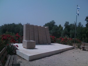 Located in the rear of the center’s courtyard is a moving memorial composed of large standing stone slabs engraved with the names of family members of the village who had perished in the Holocaust. A memorial plaque erected by the second generation of residents, commemorates the struggle of their parents who had survived the Holocaust to ultimately settle in Beit Lehem Ha Glilit.
 To truly appreciate the beautifully maintained homes with their colored shutters, flower boxes, and porches, be sure to glance into their lush front and back gardens and walk along some of the adjacent paths and alleys.
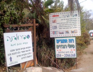
Down one such path is the rear entrance to the Spirulina soap and oil “company”. There, under the direction of Eli, groups of children and their families can enjoy making molded mobiles using soap and glycerin. Spirulina also provides lessons in the art of oil and soap making, and Eli can also arrange ATV rides for you and your family through the surrounding countryside. These rides can be especially enjoyable in spring and winter when the cyclamen, anemones, and irises are in bloom. Group activities should be scheduled in advance by calling 050-540-4034.
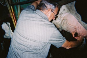 As you walk toward the end of the main street, a treat awaits both young and old at the Brandes dairy farm, www.shvilparot.co.il .There, owner Zvika Brandes will be happy to provide a personalized tour of his farm where 100 cows provide milk to the Tnuva dairy company. It’s fascinating to observe the operation of this highly mechanized farm with its robotic milking machines and computers registering the daily intake of food for each cow. But, it’s even more fun to hand milk a cow or feed an new born calf!
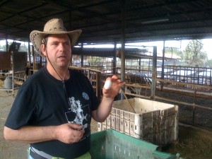 Zvika will also be pleased to relate the story of his parents who started the farm in 1957 with one cow provided by the government and a mule which they shared with a neighbor. On the second floor of the farm house Zvika’s parents raised chickens while also selling poppy seeds which grew in the nearby fields. Soon they were able to purchase additional cows, and by 1962 the dairy farm had become mechanized.
You may also wish to stop at the nearby home of Kobi and Nurit Fleischman, who maintain on the first floor a museum of village artifacts, photographs and other memorabilia. Kobi is an expert on local Templer history and will be pleased to give you a tour of the village for a fee. He can be contacted at 052-355-6939.
As we near the end of our day, a brief stop at nearby Bet She’Arim National Park would help place the region into its historical context. Long before modern Israelis settled in Alonei Abba and Beit Lehem HaGlilit, their forefathers established many Jewish settlements in the lower Galillee. One of the most significant of these, was the fortified city of Bet She ‘Arim, which in its heyday in the 3d and 4th centuries C.E., boasted a synagogue, religious school, public buildings and private dwellings. Archaelogical remains of these edifices can be viewed from the side of the road as you enter the national park. (as you leave Beit Lehem HaGlilit proceed right on Route 75 and immediately left on Route 722 to the park).
For a brief time the city was home to ancient Israel’s foremost judicial and ecclesiastical body, the Sanhedrin, and its leader Rabbi Yehuda Hanassi, who is today revered for his work in redacting the Mishna ( compilation of Jewish law). Many of Judaism’s greatest sages were educated at Bet She’Arim’s religious schools by Rabbi Hanassi and his two sons, Rabbi Gamliel and Rabbi Shimon, whose names may be familiar to readers of the Passover Haggadah. At his death, Rabbi Yehuda Hanassi was buried at Bet She’ Arim, and for many generations thereafter, Jews from Israel and the diaspora sought to be buried in the cemetery nearby this great sage. It is this necropolis of 30 excavated tombs, with their ornate stone carved facades, that we will now be visiting.
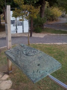 Start your walking tour at the information square where you can view a topographical map of the excavated city, the cemetery and several reliefs of Jewish symbols found in the tombs. Though it’s certainly worthwhile to follow the map in the brochure, if time is limited, you should make a point of stopping at the tomb of Yehuda Hanassi, the cave of the coffins, as well as at the mausoleum museum.
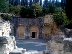 Though it is closed to visitors, the Cave of the Syrian Jews, is composed of four chambers with burial niches. Its most significant feature is the beautifully stoned carved seven branch menorah, and the Greek and Aramaic curses carved into the walls. Tomb number 14, the burial chamber of Rabbi Yehuda Hanassi, has an impressive stone facade with three arched doorways facing a large courtyard. The names of the rabbi’s sons are inscribed on the walls, and to the rear of the cave, two graves are cut into the bedrock according to the wishes of Rabbi Hanassi.
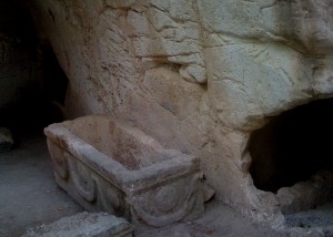 Perhaps the cave of the coffins is the most interesting of the tombs for its size and the large number of beautifully decorated sarcophagi found therein. It is also referred to as the Cave of the Rabbis for its many inscriptions recalling the names of these educators and spiritual leaders. Some of the 135 sarcophagi include intricately carved representations of animals, while on one is a carving of Nike, the Greek Goddess of Victory. The variety of Jewish symbols, such as the menorah, ram’s horn, ritual palm frond, and citron, decorating the burial chamber, together with the use of Hebrew, Aramaic and Greek languages, with their accompanying pagan representations on the coffins, is indicative of the culture and beliefs of Jews in Eretz Yisrael and the Diaspora at the beginning of the first millennium.
The mausoleum/museum has a beautiful display of archaeological artifacts, several stone and lead sarcophagi, as well as a collection of stone doors carved in a manner to imitate the wooden doors of the deceased’s residence. Similar doors are found at the entrance to each tomb.
This concludes our tour illustrating the mark that ancient Jews, Arabs, Christians and Israelis have left on this small area of the lower Galilee. If you’re planning a trip to Israel, you can retrace your return to Jerusalem or Tel-Aviv using the directions above.
Sources:
The Jerusalem Post
Society For The Preservation of Israel Heritage Sites
Israel Tourist Office
The Israel Nature and National Parks Protection Authority
November 16th, 2010 at 11:13 pm
A very accurate and well presented article! Superlative restoration as well as research on the Unger House in Waldheim has been done Dr. Ruth Liberty-Shalev at the Haifa Technion. I know Ernst Unger, son of the original builders well through his daughter, Ingrid.
You mentioned in one paragraph that the Wadheimers joined the Nazi Party. It was a lamentable fact that many did, or if not, nevertheless had Nazi ideology incorporated into their schooling and festivals. However Ernst, despite considerable pressure being brought to bear, refused membership as well as such activities. This is historically documented.
He was amongst those young men from Waldheim who were instructed by the German Consulate to go to Germany or face internment in the event of war. In Germany due to his language skills, Ernst was recruited by the Abwehr under Canaris.
On the East Front he witnessed terrible atrocities – and after being injured asked for a transfer to North Africa where he was, in his own words, fortunately captured at Tunis on 9 May 1943 and spent the rest of the war in the USA.
What he saw resulted in his having major nervous breakdowns – nothing of course to what the victims themselves experienced. However so severe became his depression that at the age of 80 he had Electro-Shock Treatment.
Now at 93 years of age he is at long last prepared to talk at some length at what he saw. This coming week I am making a proper length video of him recalling these long suppressed experiences. As Yehuda Bauer so rightly pointed out, the role of the ‘Zuschauer’ (Bystander) is not an easy to define category in the Shoah.
Please do not hesitate contacting me. We live near Melbourne, and he lives 900 kms away in Tanunda, South Australia, We should be back next week.
Shalom and warm greetings,
Ivan Himmelhoch
58 Doolen Road
North Warrandyte
Victoria 3113
Australia
+61-3-98440332
November 22nd, 2010 at 9:58 pm
Here are some photos that the Unger family gave me permission to copy from an album and send to whoever might be interested. They include the dark side of Waldheim I mentioned above. But when walking through an area knowing the whole history does help me at least get a feeling for where I am.
One of the photographs I titled as depicting a fancy dress party of children at Waldheim. If I did not know the source, I would have felt it showed a Purim Spiel – which I have attended enough times to know! Most of the photos are titled.
The photo of the Waldheim ‘Maibaum’ or May Tree, has a swastika banner heavily blued out on the right side, but still very visible. Ernst Unger tried to obliterate the swastika emblem after the war. Visitors may be interested to know that he feels in short that even the ordinary German Army (Wehrmacht) has a lot to answer for re the genocidal murders during the Shoah in areas usually associated more with Einsatzgruppen.
There is no copyright in any of them – confirmed by the daughter of Ernst Unger who occupies a senior government position in the area of Copyright here!
Shalom, and, as always, all the best,
Ivan Himmelhoch
Attached Photos With Comments Below:
13 Anhänge — Alle Anhänge herunterladen Alle Bilder anzeigen
Maibaum_Swastika_Blued_Out_c.1937.JPG Maibaum_Swastika_Blued_Out_c.1937.JPG
381 K Anzeigen Download
Hitler_Jugend_Walter_.jpg Hitler_Jugend_Walter_.jpg
243 K Anzeigen Download
Childrens_Fancy_Dress_.JPG Childrens_Fancy_Dress_.JPG
99 K Anzeigen Download
Hitler_Jugend_Walter_and_Ernst_c.1938.jpg Hitler_Jugend_Walter_and_Ernst_c.1938.jpg
402 K Anzeigen Download
Children_Swimming_under_Bridge_c.1924.jpg Children_Swimming_under_Bridge_c.1924.jpg
349 K Anzeigen Download
Waldheim_Large_Gathering_c.1927.JPG Waldheim_Large_Gathering_c.1927.JPG
673 K Anzeigen Download
Wldheim_Childrens_Outing_c1925.JPG Wldheim_Childrens_Outing_c1925.JPG
325 K Anzeigen Download
Family_Part_c.1926.JPG Family_Part_c.1926.JPG
219 K Anzeigen Download
Kurt_with_Cows_on_Unger_Farm_c.1939.JPG Kurt_with_Cows_on_Unger_Farm_c.1939.JPG
407 K Anzeigen Download
Young_Worker_with_Horse.jpg Young_Worker_with_Horse.jpg
207 K Anzeigen Download
Waldheim_Young_Womens_Hairstyles_c.1936.jpg Waldheim_Young_Womens_Hairstyles_c.1936.jpg
295 K Anzeigen Download
Imperial_German_Flag_Held_Ernst_and_Walter_c.1926.JPG Imperial_German_Flag_Held_Ernst_and_Walter_c.1926.JPG
234 K Anzeigen Download
Der_Große.jpg Der_Große.jpg
1048 K Anzeigen Download